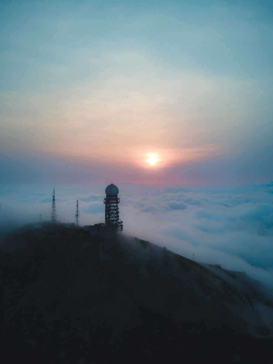
Hong Kong is surrounded by mountains. That means Hong Kong is also surrounded by lots of hikes. Tai Mo Shan is one of the best.
From Lion Rock to Kowloon Peak, Dragons back to Victoria Peak; there so many different options to choose from when it comes to hiking in Hong Kong, all within a short distance of the city.
Speaking of peaks, many people think that Victoria peak is the tallest point in Hong Kong, but it’s not. That record belongs to Tai Mo Shan. Tai Mo Shan is Hong Kong’s tallest peak at 957m.
Tai Mo Shan in cantonese literally translates to “Big hat mountain”. The “hat” referring to a common occurrence that happens atop this peak - love it or hate it, it’s fog.

Due to the unique combination of humidity and height, This mountain peak receives more cloud action than any other area in all of Hong Kong. In fact, Tai Mo Shan has been called Hong Kong’s ‘most misty area’.
In both summer and winter, you can expect regular occurrences of fog and cloud to roll under and through the mountain, giving an ethereal feel as it starts to combine cityscape and mountain.
At a ground level, it means that occasionally, hikers will be enveloped by fog and light mist, with little to no visibility in some instances. However if the fog is low, the ‘sea of clouds’ phenomenon from the view at the top is quite common and quite spectacular.

From the air however - if you have a drone - it’s an even better story.
If you’re able to get up in the air and over the clouds, you’ll be rewarded for some of the most breathtaking sights Hong Kong has to offer - something to make even the locals jealous of.

How to get to Tai Mo Shan
There’s two ways to get to Tai Mo Shan.
One way is the easy way, and it’s not really a hike. The other is the hard way, which is a 4-6 hour return journey hike and is of moderate difficulty.
The easy way is to start at Tai Mo Shan Country Park Visitor Centre, located at the bottom of Tai Mo Shan road, near Route Twisk. From there, it’s a pretty leisurely hour and a half walk up a paved road with a slight incline. If you happen to be catching a cab, you can take an even easier ‘hike’ by getting your cab driver to drop you off at the top car park and walking the rest of the trail (about a 40 minute walk from there).

Maclehose trail stage 8
This is the hard way.
Throughout Hong Kong you’ll find a trail that stretches over 100km (62 miles) of the north of Hong Kong.
Out of 10 stages, stage 8 is a 9.7km (6 mile) section that passes through the tallest mountain - Tai Mo Shan.
The start of stage 8 begins at a place called Lead Mine Pass. To get there, make your way to Tai Po Market MTR. From there, you can either choose to catch the minibus (route no.23S) to Yuen Tun Ha and walk 1.7km (1.05 miles) to get to the starting point, or you can catch a cab up to Lead Mine Pass right from the MTR.
The trail goes from Lead Mine Pass, through the peak of Tai Mo Shan, and down the other side to Route Twisk.

How to capture Tai Mo Shan
For photos, the best spot isn’t actually the top where the weather station is. It’s just below that, right here.
From that vantage point, you can get see the rest of Maclehose trail, and have the best perspective to capture the cityscape.
It doesn’t really matter if you choose sunrise or sunset, that position is facing south so you’ll get both from that spot.
However if you’re there solely for the photos, I suggest catching a cab as far up the mountain as you can get and getting there before sunrise while it’s quiet.
The views from here are spectacular. Bring a long lens with you incase the weather is clear, but also bring a wider one to capture the trail walking up. Even better, bring a drone and capture everything from the sky - you wont regret it.
If you’re going on the hike, pack light - it’s a hard one.
Bring an all rounder lens like a 24-70 and a small drone if you can fit one. You’ll need the space for water.


1 comments
MARIBEL TAMULA @ Sat, Jan 23, 21
Soon I can reach there I need to find where to go there it’s nice to hike there , can calm your mind and love’s adventures and see the beautiful spots around that mountain. Very nice.♥️👍